
The near-certain trader consensus against a hurricane forming by May 31 arises from the Atlantic basin’s climatology, where the official season begins June 1 and May hurricanes have occurred only a handful of times since 1851. National Hurricane Center daily outlooks initiated May 15 confirm no tropical disturbances or waves with development potential through late month, driven by persistent high vertical wind shear, drier mid-level air, and below-average sea surface temperatures that inhibit organization. NOAA’s seasonal outlook on May 21 is expected to reinforce this suppressed early pattern. While an undetected disturbance could theoretically intensify rapidly in the final days, current model consensus and NHC monitoring show no realistic pathway for a system to reach hurricane strength on the Saffir-Simpson scale before the deadline.
Experimental AI-generated summary referencing Polymarket data. This is not trading advice and plays no role in how this market resolves. · UpdatedWill a hurricane form by May 31?
Will a hurricane form by May 31?
$50,559 Vol.
$50,559 Vol.
$50,559 Vol.
$50,559 Vol.
The resolution source for this market will be NOAA’s list of named storms during the Atlantic hurricane season (https://www.nhc.noaa.gov/data/tcr/) and/or their data on individual storms.
If there is a potential named storm that has not yet been classified by May 31, 11:59 PM ET, the market may remain open until June 1, 12:00 PM ET to determine if a classification was made prior to midnight.
Market Opened: Dec 4, 2025, 3:05 PM ET
Resolver
0x65070BE91...The resolution source for this market will be NOAA’s list of named storms during the Atlantic hurricane season (https://www.nhc.noaa.gov/data/tcr/) and/or their data on individual storms.
If there is a potential named storm that has not yet been classified by May 31, 11:59 PM ET, the market may remain open until June 1, 12:00 PM ET to determine if a classification was made prior to midnight.
Resolver
0x65070BE91...The near-certain trader consensus against a hurricane forming by May 31 arises from the Atlantic basin’s climatology, where the official season begins June 1 and May hurricanes have occurred only a handful of times since 1851. National Hurricane Center daily outlooks initiated May 15 confirm no tropical disturbances or waves with development potential through late month, driven by persistent high vertical wind shear, drier mid-level air, and below-average sea surface temperatures that inhibit organization. NOAA’s seasonal outlook on May 21 is expected to reinforce this suppressed early pattern. While an undetected disturbance could theoretically intensify rapidly in the final days, current model consensus and NHC monitoring show no realistic pathway for a system to reach hurricane strength on the Saffir-Simpson scale before the deadline.
Experimental AI-generated summary referencing Polymarket data. This is not trading advice and plays no role in how this market resolves. · Updated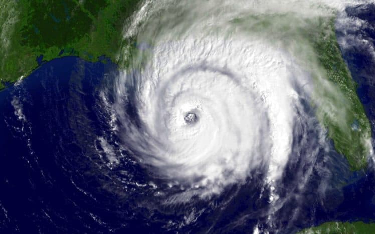


Beware of external links.
Beware of external links.
Frequently Asked Questions